By Israel Gonzalez – NWS Tallahassee
Video captured by VARC members of the tornado.
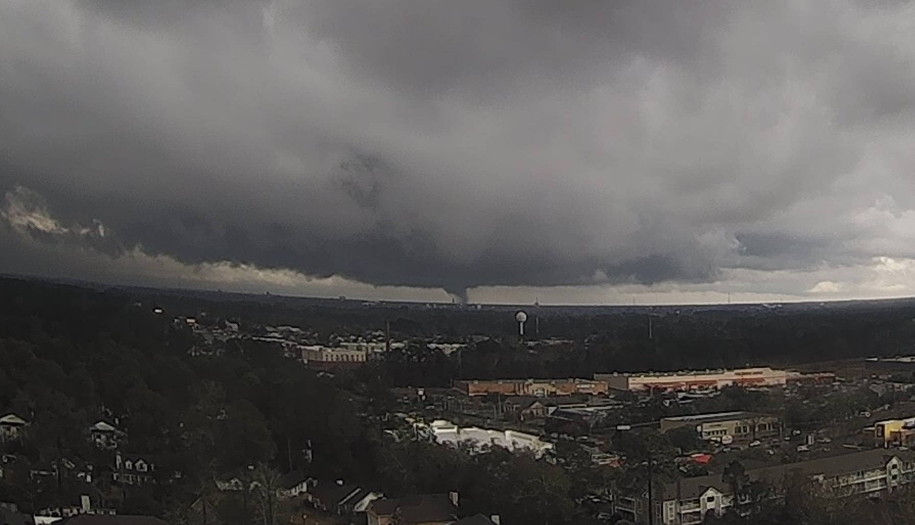
On February 4th, an area of low pressure developed near the Gulf Coast and moved inland over the NWS Tallahassee forecast area. This system produced 3 confirmed tornadoes, one of which was an EF-2 in Lowndes County, GA that injured 2 people. What made this tornado unique and challenging to warn on was that it developed in a low-precipitation area with respect to the parent storm. This article gives an inside look at key moments during the crucial 5-minute warning-decision process. At 305pm ET, there were no radar indications of a tornado amidst ongoing storms, but the reality was that there was one unknowingly on the ground at that point. A 307pm ET, a crucial chat comes into our Slack Channel (NWSChat 2.0) from a HAM/ARES radio operator, with an attached image (bottom-right) of an apparent distant tornado from a water tank cam in SE Valdosta. At 308pm ET, the warning forecaster, Don Van Dyke (DVD) replied to the operator asking what direction the camera was facing, then pivoted to the Valdosta area on radar to examine more closely where the potential tornado could be, and identifies a low-precipitation area separated from the main storm just to its NW. At this point, DVD drafted a warning for that suspicious area while anxiously awaiting the operator’s response, for which at 309pm ET, came back as “at the Valdosta Cinemas facing southeast”. A fellow Lead Forecaster on shift, Karleisa Rogacheski (KR) then quickly pinpointed the exact location and it aligned with the suspected area on radar. The Tornado Warning was subsequently issued at 310pm ET. Moments later, the next radar scan revealed a sudden spike in the reflectivity in the low-precipitation zone, coincident with debris being lofted in the air by the tornado, itself.
“It is the single best chat I’ve ever gotten in my career so far”.
The operator’s chat saved at least 1-2 minutes on the tornado warning issuance time. Without his chat, the tornado may have not been recognizable on radar until 310pm ET. Residents said they got the warnings with enough lead time to seek shelter. For DVD, it was the most challenging tornado warning decision of his 15-year NWS career and commented that, “It is the single best chat I’ve ever gotten in my career so far”. As for KR, it was a career-defining moment for which she said, “These stories are a powerful reminder that our work matters. Had it not been from Randy (KN4SHQ) sharing those images with us and DVD jumping into action to get the warning out, lives may have been lost.” Additional kudos must also be given to the following forecasters who made strong contributions during that shift: Lance Franck, Kristian Oliver, Joe Worster, and Jasmine Montgomery.